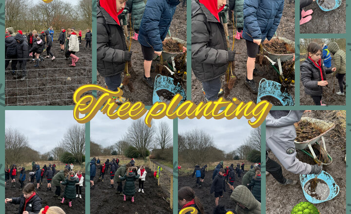
Year 6 - Tree Planting
Today, as part of our whole school sustainability project, Year 6 proudly contributed to the micro forest by planting a variety of trees in Jack’s Key with support from Lancashire County Council Treescapes and Blackburn with Darwen Borough Council. This exciting opportunity allowed the children to take positive action in caring for their local environment and to understand the important role trees play in supporting wildlife, improving air quality and tackling climate change. Working together in teams, the children carefully planted each sapling, learning about the different species and how they will grow over time. They showed fantastic teamwork, responsibility and enthusiasm throughout the activity. This hands on experience not only supports our school’s commitment to sustainability but also helps to create a lasting legacy for future pupils and the wider community.
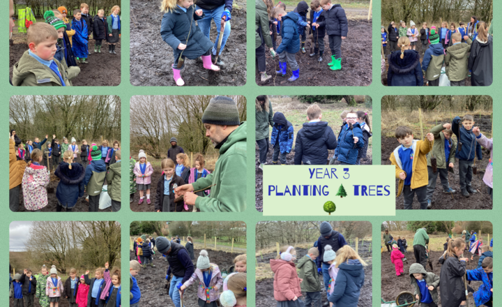
Year 3’s Microforest Adventure- Planting Trees
Year 3 are thrilled that our school is partnering with Blackburn with Darwen Council and the Lancashire County Council Treescapes team to create a brand-new microforest. The children had an absolutely fantastic time getting stuck into the soil! The planting team were genuinely impressed by the children's impressive knowledge of local trees and birds. We have some truly talented budding ecologists in our midst. The students showed such care and dedication while planting, and they are already buzzing with excitement to return and watch "their" trees flourish over the coming years. A huge well done to Year 3 for being such incredible ambassadors for our environment and for leaving a lasting green legacy for our community!
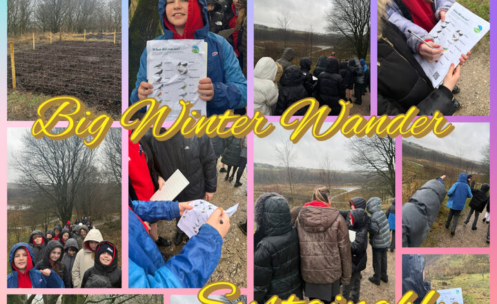
Year 6 - Big Winter Wander
As part of the Big Winter Wander, Year 6 enjoyed a walk around Jack’s Key, making the most of the crisp winter weather to explore our local environment. During the walk, the children carefully observed their surroundings and learned more about our whole-school sustainability project and the positive impact it aims to have on our community. The children took part in bird watching, using a tally system to record the number and types of birds they spotted. Among the species identified were wood pigeons, carrion crows, starlings, magpies and chaffinches. The children showed great patience and enthusiasm as they quietly observed and counted the wildlife around them. Once our micro forest is fully established, we plan to repeat this survey and compare the results. This will help us to see whether biodiversity has increased and whether our project has successfully created a richer habitat, providing food, shelter and safe nesting spaces for a wider variety of wildlife. Donations to WWF can be made here: https://socialsync.app/fundraiser/cr-nzymxvnokwdn?currentTab=feed
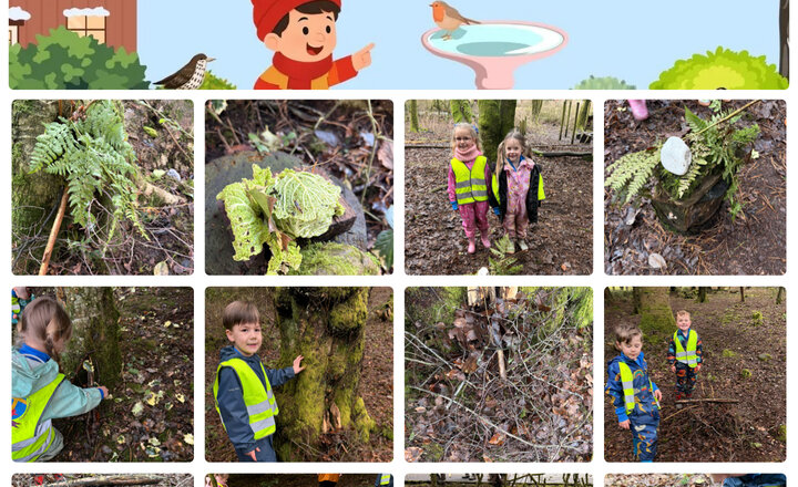
Reception: Muddy Monday
As part of the Ruby Robin Award, our Reception class participated in the "Craft and Care" challenge today. The children visited Whitehall Park to build bug houses using resources they collected themselves. We are incredibly proud of their hard work and creativity; we even saw some bugs starting to move into their new homes! Well done to our Reception class on a fabulous job.
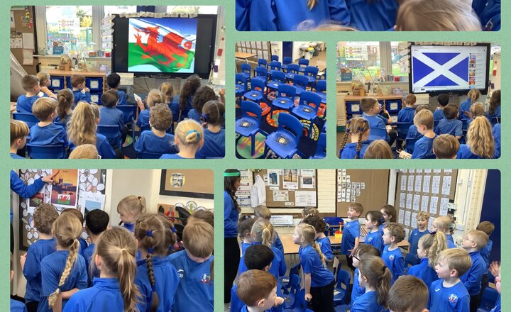
Year 1 Geography: Exploring UK Capitals
Today Year 1 flew around the United Kingdom to visit our capital cities London, Cardiff, Belfast and Edinburgh. Whilst on our airplane flying to the cities, we matched the countries (England, Scotland, Wales and Northern Ireland) to their flags in our passports. We also listened to each country’s National Anthem. When we arrived in our capital cities, we explored a human feature and a physical feature in each city. For example, in London we explored Big Ben and River Thames. To share our knowledge, we wrote postcards to Mrs Ham to explain where we had been on our travels and what they had learnt.
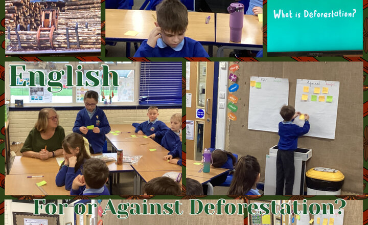
Year 4 - English: For or Against Deforestation?
This week in Year 4, we started our new English topic on debate texts and the children learned some facts about deforestation. First, they recorded a fact they learned from the video and decided if it was an argument for or against. They then worked in groups to consider whether the printed statements were arguments for or against. The children will be working up to writing their own debate texts, forming a balanced argument.
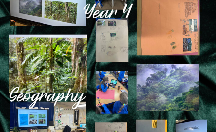
Year 4 Geography - Features of a Rainforest
Our geography lesson this week focused on the features of a rainforest. The children researched three key areas; Rainforest people, Rainforest food and Rainforest Animals. They focused on both The Amazon and Congo rainforest s. Working in groups, the children produced some super posters which they presented to the rest of the class at the end.
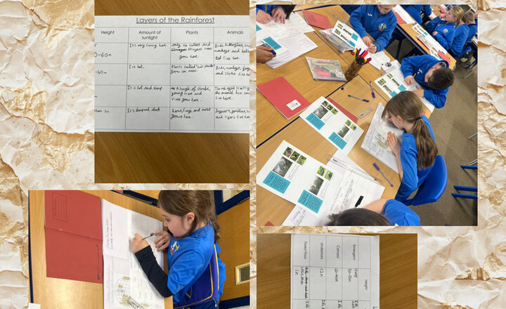
Year 4 Geography - Rainforest Layers
In our Geography lesson we have been looking at the layers of a rainforest. The children identified the four layers as the forest floor, the understory, the canopy and emergent layer at the very top. Using their enquiry skills they researched the climate, plant and animal life and height of the trees at each layer.
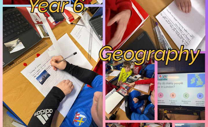
Year 6 - Geography
Today in Geography, the children began the lesson with a diagnostic question exploring why people might choose to live in London. Using talk tokens, they practised their oracy skills by sharing ideas, listening carefully to one another and building on responses within their groups. This supported thoughtful discussion and helped pupils justify their opinions. The lesson then moved on to exploring how human activity has shaped and changed the landscape. The children examined key concepts such as urbanisation, agriculture and erosion management, considering both the positive and negative impacts humans can have on the environment. They used examples to deepen their understanding and made links to real-life locations, developing their geographical vocabulary and critical thinking skills throughout the session.
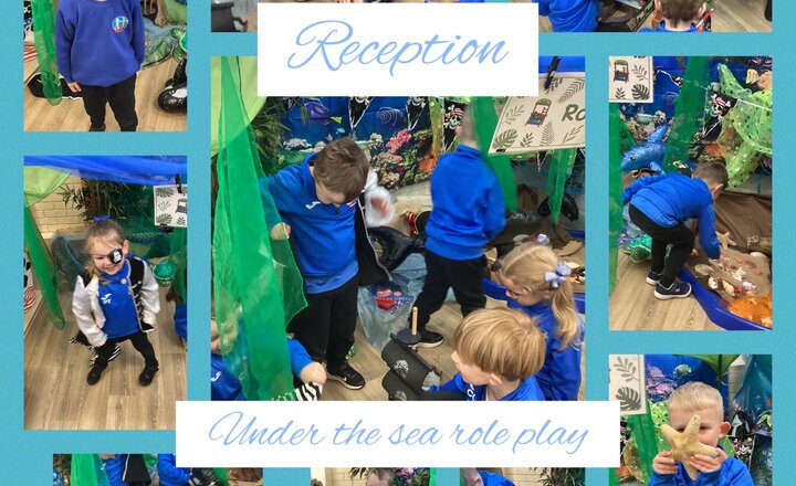
Reception: Under the Sea
Reception class have launched their under the sea topic this week. They have an under the sea roleplay and have enjoyed exploring the different sea creatures and under the sea treasures. The children have also enjoyed being pirates and roleplaying stories together.
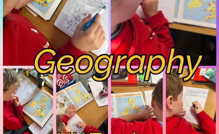
Year 6 - National Parks of the United Kingdom
Today, Year 6 used an atlas to explore the national parks of the UK. The children investigated where the national parks are located and discussed why tourism is such a big industry in these areas. The children also explored how the UK benefits from tourism, including job opportunities, support for local communities and the protection of natural environments.
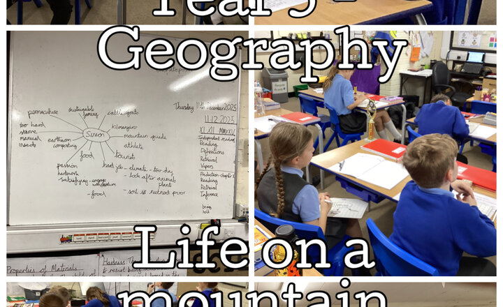
Year 5 - Geography
In Geography we have explored the physical aspects of mountains including how they are formed and their unique climate. Now we are moving onto the human aspects, studying the lives of people who live on them. We found out about the harsh lives of farmers who live near Mount Kilimanjaro and Mount Everest, and how they have to supplement their income through tourism while dealing with the challenges of their isolated rural existence.